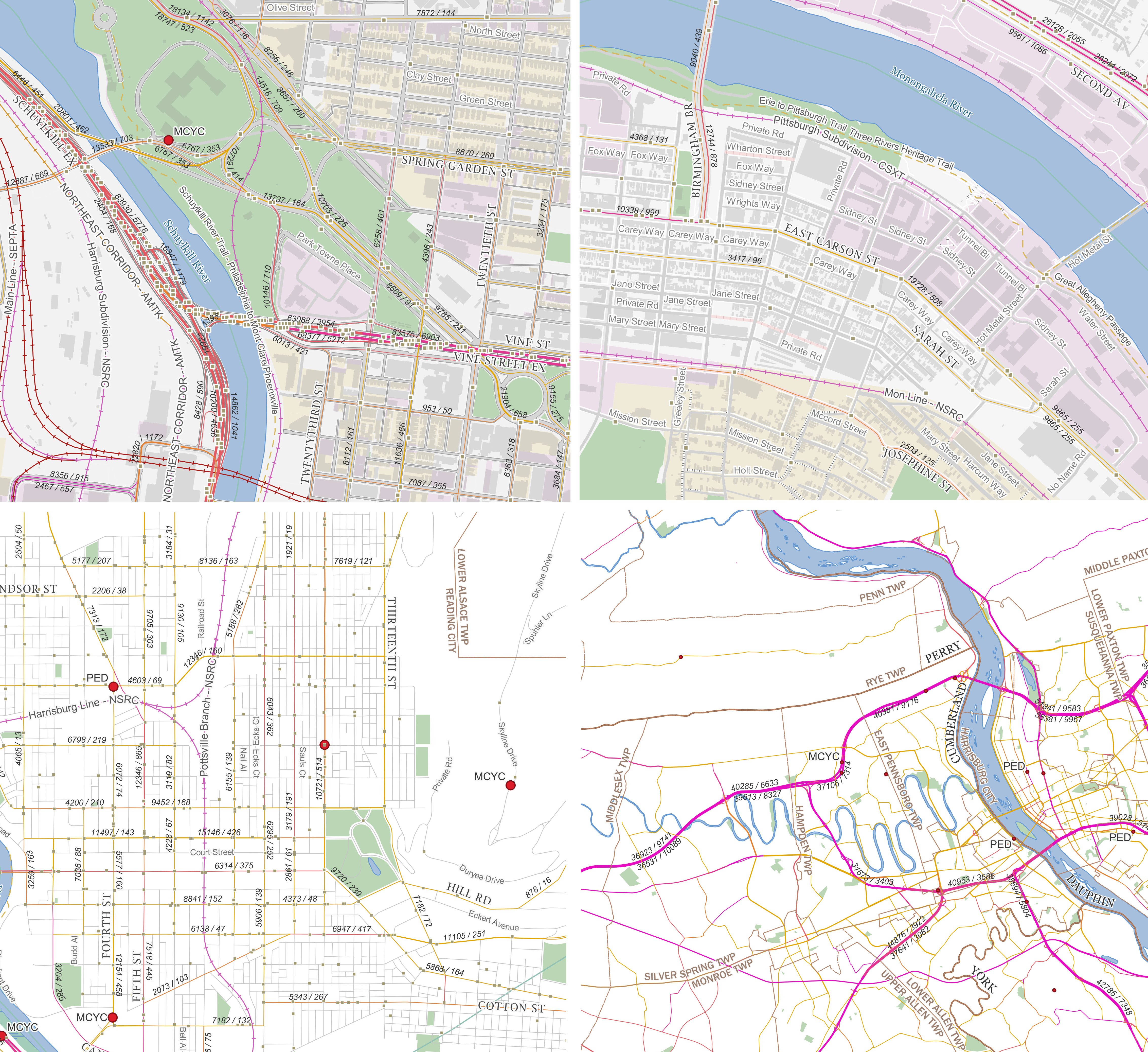
This is a short blog post, but it contains a downloadable! I spent a couple of weeks using as many publicly available shapefiles and other map data, provided by PennDOT and various counties, in an attempt to create the most intuitive traffic map of Pennsylvania. My objective of creating this map was to visualize several trends:
- Trend of car accidents with respect of other elements, such as cartway width, pedestrian crossing locations, or presence of physical barriers.
- Correlation between mixing of land use, commercial or residential, with traffic count. (Such land use classification data is only readily available for Allegheny, Philadelphia, and several neighboring counties)
- Understanding the accessibility needed for truck routes, with the recognition of such routes needing larger lanes and paved turning paths.
Download the Traffic Map here.
This map requires QGIS to run. QGIS is a free and open source GIS mapping program. Download QGIS here.

Map legend and description:
- Traffic - available only for major routes - are indicated in AADT, or annual average daily traffic. The AADT on the map is listed in the notation of Total traffic / Truck Traffic. Roads marked with an orange line indicate low truck traffic is present on such road, with purple lines indicating a common presence of trucks. Data sourced from PennDOT’s traffic map of 2022.
- Roads - Roads marked in gray have either concrete or bituminous pavement. Roads marked with red stripes are paved with either brick or belgian blocks. Note that the pavement classification has a few places where the pavement was inaccurately logged. All roads are shown to cartway scale when zoomed in. Sourced from PennDOT’s Local Road Map, 2022.
- Crashes - Taken from PennDOT crash data from 2019 (Pre-pandemic). Indicated as follows:
- Nonfatal - marked with small gray dot.
- Fatal - marked with large red dot. When zoomed in, a bubble next to the crash location provides a summary of the circumstances that may be relevant to the fatality. The crashes are further annotated with the following codes:
- PED - Fatal pedestrian crash
- MCYC - Fatal motorcyclist crash
- CYC - Fatal cyclist crash involving a motor vehicle
- MULT - Multiple fatalities
You are free to use my work, credit being optional. All work was done on my own time and is not sponsored by any employers.